- Loading…
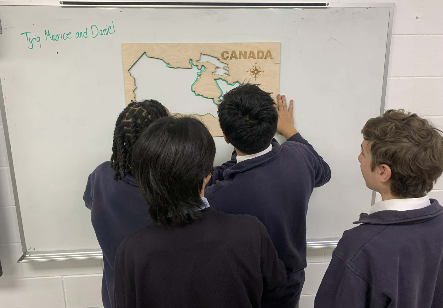
In this lesson, students will explore the evolution of Canadian borders from 1837 to the present day through an interactive mapping game. Using a stencil of Canada, they will visualize how key historical events—such as the Act of Union (1840) and Confederation (1867)—shaped the political geography of the nation. This activity emphasizes the relationship between geography, colonization, migration, and federalism, encouraging both teamwork and historical reasoning.
Materials
Downloads:
By the end of this lesson, students will be able to:
Question 1
Could you have done this activity without the teaching aid you have fabricated? How do you think digital fabrication improves the activity vs utilizing traditional methods? What is the extra value?
Yes, this activity could have been completed without the teaching aid; however, the digital fabrication adds significant value and enhances the learning experience. While students could simply look at printed maps or draw freehand, using a fabricated stencil allows them to physically engage with Canada’s geography in a more interactive and memorable way. The hands-on act of drawing borders helps reinforce spatial awareness and encourages students to connect historical events with visual changes on the map. By physically tracing and labeling borders, they can better recall how political and geographic factors shaped the country over time. Additionally, gamifying the activity—having students compete to correctly mark borders—adds motivation and enjoyment, making the lesson more dynamic and engaging. Digital fabrication, such as laser-cut or 3D-printed stencils, ensures accuracy and reusability, offering a durable, precise teaching aid that enhances both collaboration and learning retention compared to traditional paper-based methods.
Question 2
What did you learn during the fabrication process?
During the fabrication process, I learned two key lessons that will help me in future projects. First, I discovered that thicker wood requires multiple passes to cut through properly—in this case, 3 passes were needed. This taught me the importance of planning for extra time in the fabrication schedule, as thicker materials with different glues may take longer to cut but also require careful monitoring to avoid burning or damaging the wood. Second, I realized how time-consuming it can be to prepare an effective vector drawing. I had to simplify the map by removing extra nodes to reduce unnecessary detail, which made the final stencil easier for students to trace with markers. This experience showed me the balance between accuracy and practicality—sometimes, simplifying the design improves usability. Overall, I gained a better understanding of both the technical and design considerations involved in digital fabrication.
Introduction discussion
Begin with a short discussion:
“How has Canada always looked the way it does on a map?”
“What historical events might have changed its shape?”
Timeline of Confederation to help students visualize the sequence of events.
Display a modern map of Canada.
Explain that students will “travel through time” by mapping Canada’s changing borders from 1837 to today.
Divide students into teams of 2-4
Divide students into teams of 2–4.
Have each team draw the outline of Canada from memory on the whiteboard or poster paper.
Have each team draw the actual map of Canada using the stencil.
Compare their sketches to the stencil map. Discuss:
What was easy or difficult to remember?
Which provinces or territories were misplaced or forgotten?
What might this tell us about how borders have changed or been emphasized in history?
Tracing & playing the game
Briefly discuss the historical context after each round (e.g., why new provinces were added, what political or economic factors influenced borders).
Teacher Tips
Reflection & wrap-up
Review the completed maps.
Ask students:
Emphasize the connection between federalism and geographic expansion.
End the lesson by emphasizing how Canada’s evolving borders reflect both political decisions and geographic realities. Encourage students to think about how borders continue to change through discussions of identity, reconciliation, and governance today.
Having trouble? Let us know by completing the form below. We'll do our best to get your issues resolved quickly.
"*" indicates required fields